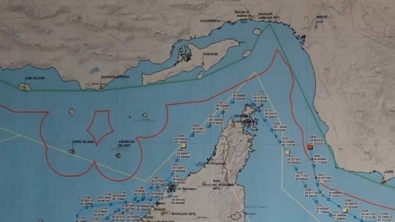
Iran Press/Iran News: Iranian Foreign Minister on Saturday on his Twitter page presented more visual details by maps and coordinates of US drone, point of impact and locations of Iranian maritime border.
Zarif presenting visual facts said in his Twitter page: "There can be no doubt about where the vessel was when it was brought down."
In the second tweet Zarif describes his maps for readers to better understand coordinates and locations.
 detailed coordinates of US military drone downed in Iran territorial water
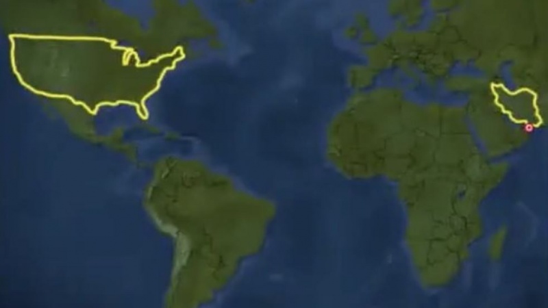
Iran's Zarif in the 3rd tweet presented another fact in a more illustrative shape.
 Location of downed drone and distance to border of Iran and the border of the United States
One last visual: Red dot is the impact point of the trespassing drone against the border of Iran; and the border of the United States.
Iran’s foreign minister on June 20 said on Twitter that the coordinates of downed US military drone shows that drone had taken off from the UAE and violated Iranian airspace, then targeted at the coordinates (25°59’43”N 57°02’25”E) near Kouh Mobarak inside Iranian territorial waters.
The Islamic Revolution Guard Corps (IRGC) had announced in a statement early Thursday that the US-made Global Hawk surveillance drone was brought down by its Air Force near the Kouh Mobarak region near the southern port city of Jask after the aircraft violated Iran's airspace.101/211/205
Read More:
Iran summons UAE Charge D’Affaires over US drone airspace violation
Firing a bullet at Iran, will engulf US and its allies: Military spokesman
Iran's next step on JCPOA will be stronger: FM spox

